Geological, Geotechnical & Geophysical Services

Comprehensive Geotechnical and Geophysical Solutions for Engineering Projects

At Ground Systems Geophysical (GSG), we provide tailored geological, geotechnical and geophysical services for engineering projects, ensuring accurate site characterization, risk assessment, and optimized design. Our multidisciplinary team combines advanced technology, data analysis, and industry expertise to help you meet the demands of your engineering projects efficiently and sustainably.

OUR

Core Services

1. Geological Services for Engineering Projects

– Site Investigations & Geotechnical Surveys: Comprehensive field investigations to assess soil conditions, rock formations, and site stability, supporting safe and efficient construction.
– Geological Mapping: Detailed mapping of geological features such as faults, strata, and rock types to inform design and construction decisions.
– Core Analysis and Testing: Collection and analysis of core samples to evaluate material properties such as porosity, permeability, and strength for accurate foundation design.
– Stratigraphy and Lithology Analysis: In-depth examination of sediment layers and rock formations to determine subsurface conditions and potential hazards.

2. Geophysical Services for Engineering Projects

– Seismic Refraction and Reflection Surveys: Non-invasive geophysical methods to identify subsurface features, detect faults, and assess bedrock depth for foundation and structural design.
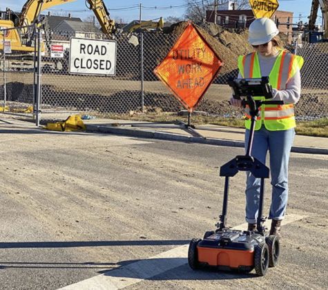
– Ground Penetrating Radar (GPR): High-resolution, near-surface geophysical imaging used to detect subsurface anomalies, utilities, and voids.
– Electrical Resistivity Tomography (ERT): Mapping of subsurface resistivity to assess soil and rock properties, moisture content, and potential hazards such as contamination or voids.
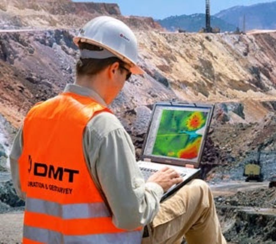
– Magnetic and Electromagnetic Surveys: Identification of geological structures, fault zones, and mineralization, providing valuable data for engineering and construction planning.
– Geophysical Borehole Logging: In-depth well logging techniques to assess subsurface conditions, including lithology, porosity, permeability, and geotechnical properties.

3. Geotechnical & Structural Support

– Soil and Rock Mechanics Testing: Laboratory and in-field testing to determine soil properties (compaction, shear strength) and rock mechanics (fracture toughness, compressive strength).
– Foundation Design Recommendations: Data-driven foundation design solutions to ensure stability and safety, including soil-structure interaction studies.
– Pavement and Roadway Design: Assessment of subgrade conditions, soil strength, and moisture content to support durable and long-lasting road construction.
– Retaining Wall and Slope Stabilization Studies: Recommendations for the design and construction of retaining walls, embankments, and slope stabilization to prevent erosion and landslides.

4. Dewatering Services

– Dewatering Planning and Design: Tailored dewatering plans to control groundwater levels during excavation and construction, ensuring the stability and safety of the site.
– Groundwater Flow Modeling: Simulating groundwater behavior to predict dewatering needs and optimize system design.
– Dewatering System Installation: Providing installation services for wellpoint systems, deep wells, and other dewatering systems to manage water accumulation during construction.
– Pump Testing and Monitoring: Ensuring dewatering systems perform efficiently with ongoing monitoring and testing of pumps, flow rates, and groundwater levels.

5. Caves and Underground Exploration

– Cave and Subsurface Void Mapping: Detecting and mapping underground cavities, voids, and caves using advanced geophysical techniques to ensure safe construction.
– Karst and Sinkhole Assessment: Identifying risks posed by soluble bedrock and sinkholes that could affect construction projects.
– Tunnel and Subsurface Exploration: Conducting geophysical surveys to assess the integrity of subsurface features for tunnel construction and underground infrastructure.
– Subsurface Hazard Identification: Identifying potential geological hazards such as unstable rock, caves, or other voids that could impact construction projects.

6. Risk Assessment & Mitigation

– Seismic Hazard Analysis: Identifying earthquake risks and assessing their potential impact on infrastructure, with mitigation recommendations for buildings and other structures.
– Flood Risk Analysis & Drainage Studies: Evaluation of flood risks and drainage capacity to prevent water damage and improve site planning.
– Groundwater and Contamination Risk Assessment: Identifying potential groundwater contamination, permeability issues, and the impact of construction activities on local water sources.
– Geohazard Mapping & Monitoring: Identification and analysis of geohazards such as sinkholes, landslides, and subsidence to prevent site hazards during construction. – Slope Stability and Landslide Risk Assessment: Evaluation of slope integrity and potential landslide risks to guide excavation and structural design.

7. Environmental and Sustainability Services

– Environmental Impact Assessments (EIA): Evaluating the potential environmental impacts of proposed engineering projects, including mitigation strategies for site development.
– Ecological Studies: Assessing the impact of construction activities on local ecosystems and biodiversity to ensure compliance with environmental regulations.
– Sustainable Engineering Solutions: Integrating sustainable design and construction practices that minimize environmental impact and optimize resource use.
– Contamination and Remediation Studies: Identifying contamination risks and developing remediation strategies for soil and groundwater protection.

Exploring the Depths

Foundations for a Sustainable Future

Geophysics reveals hidden subsurface insights, enabling safer and more sustainable developments that shape our future.

Understanding the Earth beneath our feet is the foundation of building a sustainable future above it.

Why Choose

GSG for Your Engineering Projects?

Comprehensive Data

We integrate geological, geophysical, and environmental data to provide a holistic view of your project’s site conditions, reducing risk and uncertainty.

Advanced Technology

Using state-of-the-art geophysical tools and geological analysis techniques, we ensure the highest level of accuracy and insight for your project.

Experienced Team

Our team of experts brings decades of experience in geophysics, geology, geotechnical engineering, and environmental science to each project, ensuring reliable and informed decision-making.

Risk Reduction

We identify and mitigate potential risks early in the project lifecycle, providing proactive solutions that ensure safety and reduce unexpected costs.

Tailored Solutions

Every project is unique, so we customize our services to meet your specific needs, ensuring optimal outcomes for your engineering projects.

APPLICATIONS

Infrastructure Development

Roads, bridges, tunnels, and buildings, with detailed geological and geophysical analysis to guide design and construction.

Energy Projects

Wind, solar, geothermal, and oil & gas projects, supported by geological, geotechnical, and seismic data for site characterization and resource assessment.

Environmental & Flood Control Projects

Flood risk analysis, drainage studies, and geotechnical assessments for sustainable and flood-resistant infrastructure.

Partner with GSG for Geology & Geophysics Expertise in Engineering Projects

At GSG, we provide comprehensive geological and geophysical services designed to support the full lifecycle of your engineering project. From initial site investigations and risk assessments to sustainable development and final construction, our team delivers the insights and data you need for safe, efficient, and effective project execution.

Contact Us

To learn more about how our geological and geophysical services can support your engineering projects.

+966 50 29 28 667

info@gs-geo.com

www.gs-geo.com

Get Free Quote

Comprehensive Geotechnical & Geophysical Solutions for Engineering Projects