Geophysical Services by Ground Systems Geophysical (GSG)

Accurate Subsurface Insights for Smarter Projects

At GSG, we specialize in delivering cutting-edge geophysical survey services designed to help you make informed decisions with precise and reliable subsurface data.

Solutions Tailored for Diverse Applications

Our expertise extends to engineering, environmental, and resource exploration projects. We provide customized solutions that address the unique challenges of each project type, ensuring optimal results.

Empowering Safe and Cost-Effective Planning

By providing accurate and actionable insights, we enable safe, efficient, and cost-effective project planning. Our data-driven approach helps mitigate risks and streamline decision-making throughout the project lifecycle.

OUR

Core Services

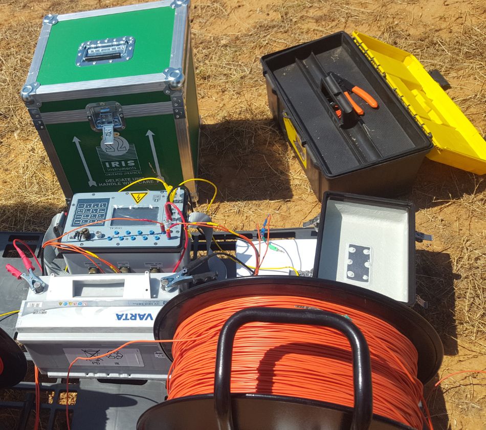
Electrical Resistivity Tomography (ERT)

- Soil & bedrock lithology
- Contaminant plumes detection
- Aquifer and water table characterization
- Pollution monitoring

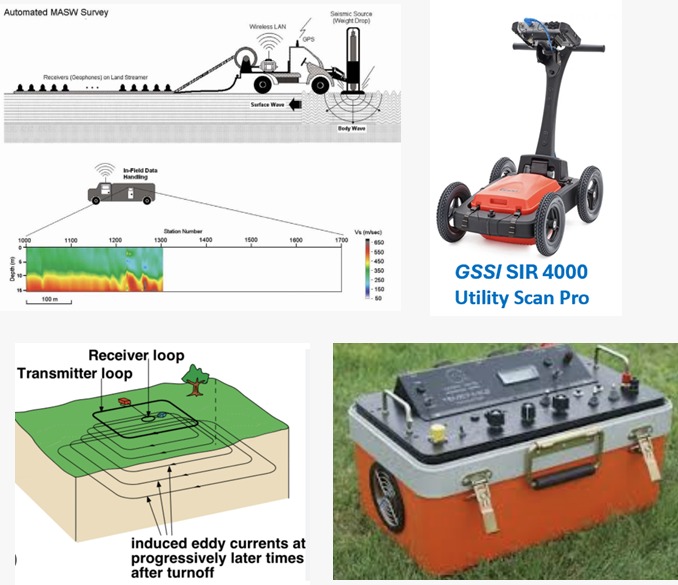
Seismic Methods

- Overburden thickness
- Bedrock topography
- P & S wave velocity analysis
- Void, fracture, and sinkhole detection

Ground Penetrating Radar (GPR)

- Utility mapping & detection
- Concrete & rebar inspection
- Subsurface void and structure mapping
- Archaeological & forensic applications

Magnetic & Electromagnetic Methods

- Mineral exploration
- Buried metal objects and UXO detection
- Fault and structural mapping
- Utility mapping & detection

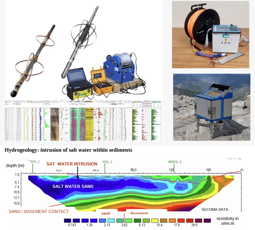
Borehole Logging

- Gamma-ray, resistivity, and density logging
- Sonic & full-wave logging
- Cement bond and acoustic televiewer logging

Gravity & Microgravity Surveys

- Detecting voids, fractures, and subsurface anomalies
- Bedrock depth determination
- Fault location & basin geometry mapping

Exploring the Depths

Foundations for a Sustainable Future

Geophysics reveals hidden subsurface insights, enabling safer and more sustainable developments that shape our future.

Understanding the Earth beneath our feet is the foundation of building a sustainable future above it.

We Use

Geophysical Methods

Electrical Methods:

- ERT, VES, TDEM, FEM, IP, CSAMT, SP
- Ideal for mapping subsurface conditions like soil composition and contamination.

Seismic Methods

- Refraction, MASW, Downhole, Cross hole
- Used to map overburden, bedrock, and determine geotechnical properties like velocity and shear modulus.

Magnetic Methods

- Magnetic surveys (with drone options)
- Detects subsurface ferrous objects and mineral deposits through magnetic field variations.

Borehole Logging

- Gamma-ray, resistivity, neutron, sonic, spectral, cement bond logging
- Provides detailed measurements of subsurface materials at specific depths.

Gravity and Microgravity

- Microgravity with CG-5 gravimeter
- Measures minute variations in Earth's gravitational field to detect subsurface features like voids and faults.

Applications

Of Our Geophysical Services

Engineering Geophysics

Site characterization, foundation design, and infrastructure development.
Applications for roads, bridges, tunnels, and other civil works.

Geohazard Detection

Sinkhole, landslide, and fault detection.
Mapping voids and assessing structural risks.

Renewable Energy

Environmental and Infrastructure Monitoring Solutions
Geophysical assessments to optimize site selection, environmental impact, and infrastructure development for renewable energy projects like wind, solar, and geothermal.

Environmental Geophysics

Pollution monitoring, groundwater studies, and environmental risk assessments.
Identifying contaminants and mapping aquifer conditions.

Archaeology & Forensics

Non-invasive investigations for archaeological sites.
Forensic applications for locating buried objects or evidence.

Exploration Geophysics

Mineral, groundwater and geothermal exploration.
Resource identification, subsurface mapping, and reservoir characterization.

Geothermal

Resource Delineation and Assessment
Geothermal Reservoir Characterization
brMonitoring Solutions
Mapping geothermal resources and assessing reservoir conditions for efficient energy extraction

Our Approach

Give Customers the most Compelling

At GSG, we combine state-of-the-art technology with deep sector knowledge to deliver reliable and actionable subsurface data. We work closely with clients to tailor solutions, ensuring that every survey aligns with project goals, budget, and timeline.

Survey Planning

Detailed planning for optimal survey design and methodology tailored to your project’s needs.

Data Processing

Use of advanced tools to convert raw field data into meaningful subsurface information.

Data Interpretation

Expert analysis of geophysical data to extract actionable insights & inform decision-making.

Report Preparation

Clear, concise, and comprehensive reporting to ensure your team has all the necessary for project success.

Why choose GSG?

  • Expertise: Highly skilled professionals using advanced techniques
  • Comprehensive Solutions: End-to-end services from survey planning to data interpretation
  • Tailored Approach: Customizable services to fit the unique needs of your project

Contact Us

For expert geophysical services and precise subsurface data, reach out to Ground Systems Geophysical.

+966 50 29 28 667

info@gs-geo.com

www.gs-geo.com

Get Free Quote